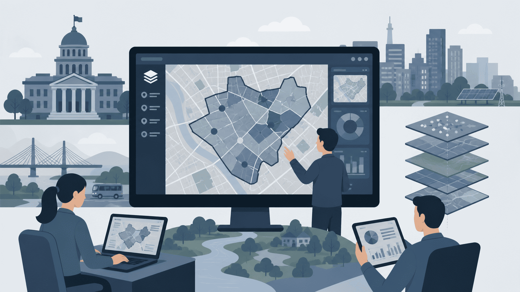
WebGIS for Smart Governance
Seamlessly integrate spatial data, manage geographic boundaries, and analyze spatial patterns with our high-performance geospatial platform.
Trusted by Organizations and Enterprises
GeekTech
CV. HSD
Djayasoft
CrossLink
DigiDesa
Comprehensive Spatial Data Management

2
Categories
Collected from all categories under dataset.

7
Layers
Collected from all layers under categories.

12,965
Datasets
Collected from submitted datasets.
Powerful Spatial Analysis & Visualization
All the tools you need to connect, visualize, and analyze your spatial data effortlessly.
Interactive Web Maps
Create highly interactive map interfaces with deep interactivity powered by our robust SDK and rendering engine.
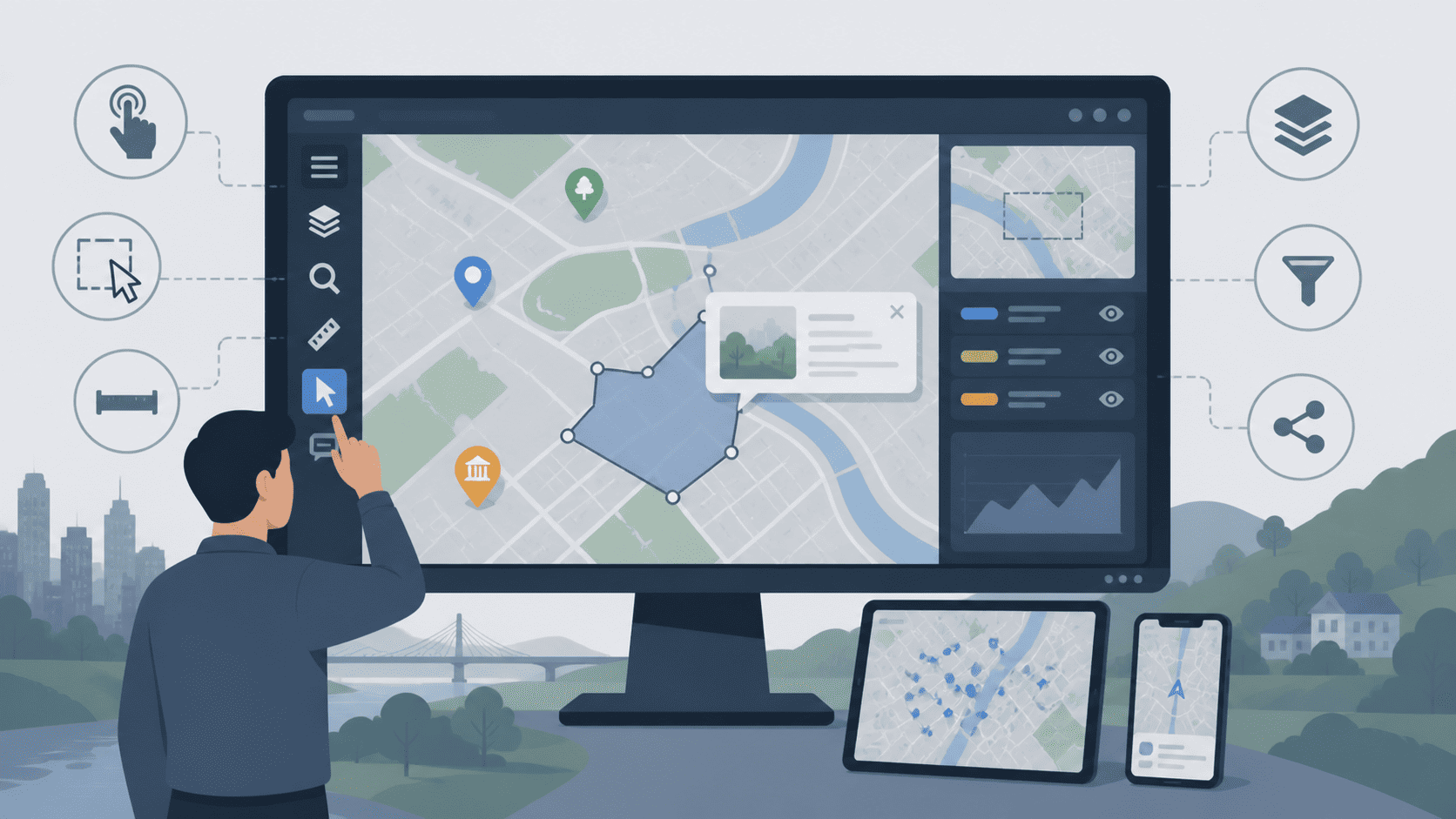
Dynamic Visualization
Render massive datasets as fast Vector Tiles and visualize complex spatial relationships in real-time.
Asset & Resource Tracking
Map your critical assets, track resources optimally, and manage hierarchical spatial data seamlessly.
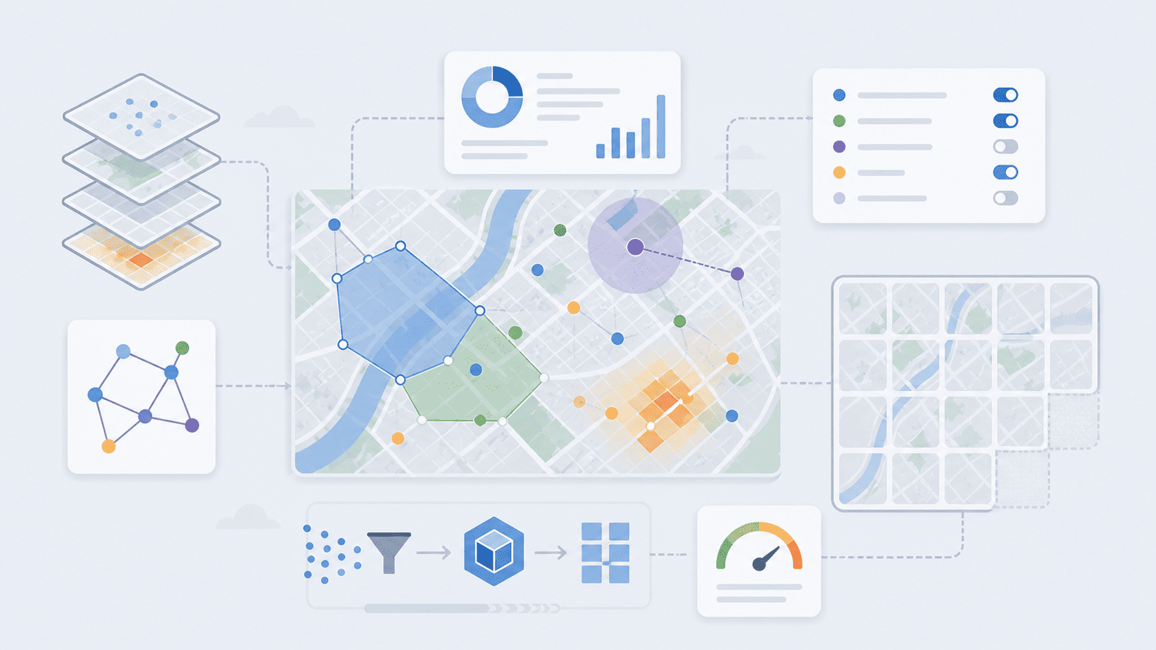
Enterprise-Grade WebGIS Engine
Engineered for performance. Seamlessly manage the entire lifecycle of your spatial data from raw integration to actionable analytics.
High-Fidelity Spatial Editing
Edit map geometries directly on the web with our advanced hybrid MVT architecture. Perfectly suited for precise geographical digitization and topology adjustments.
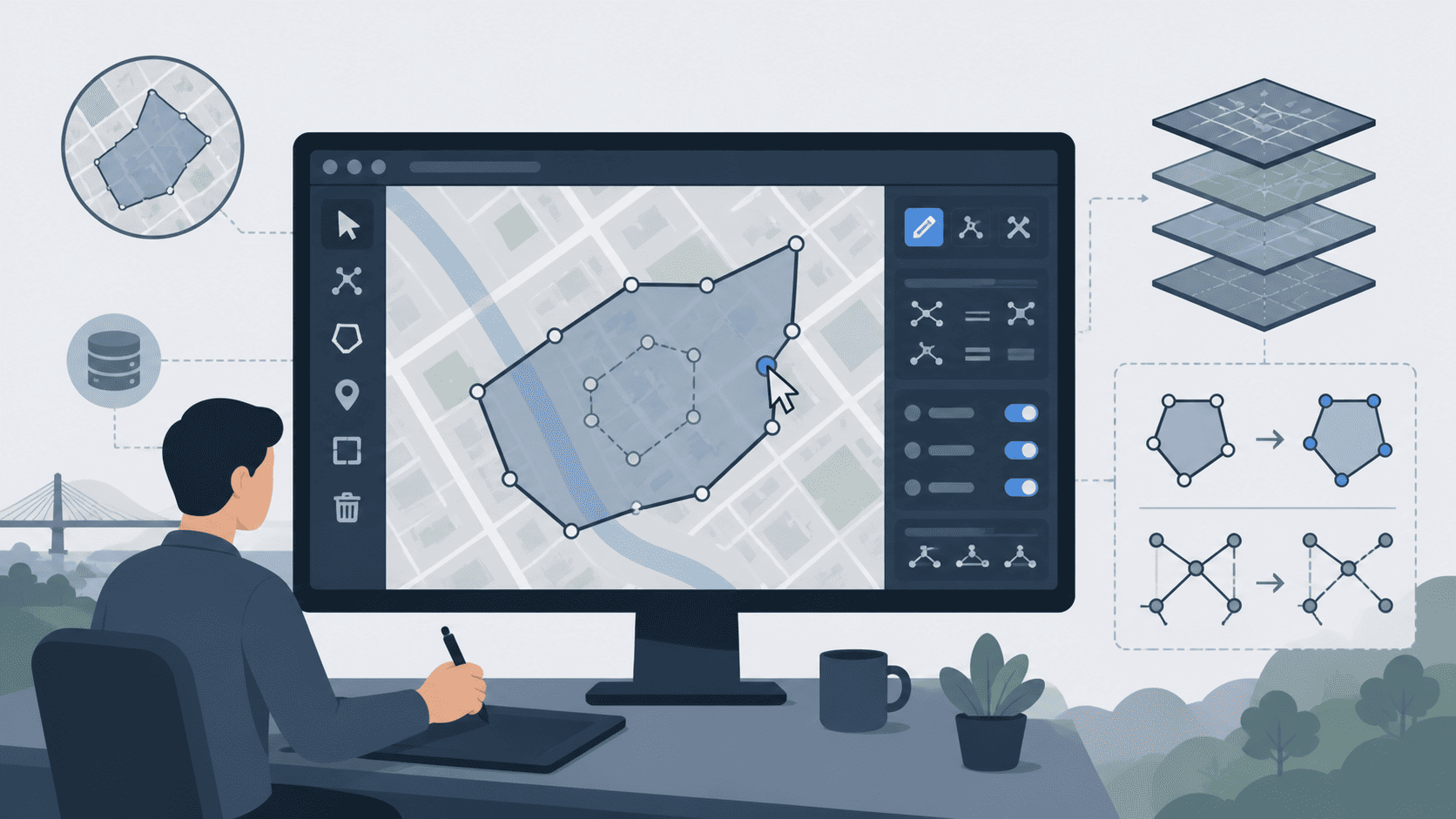
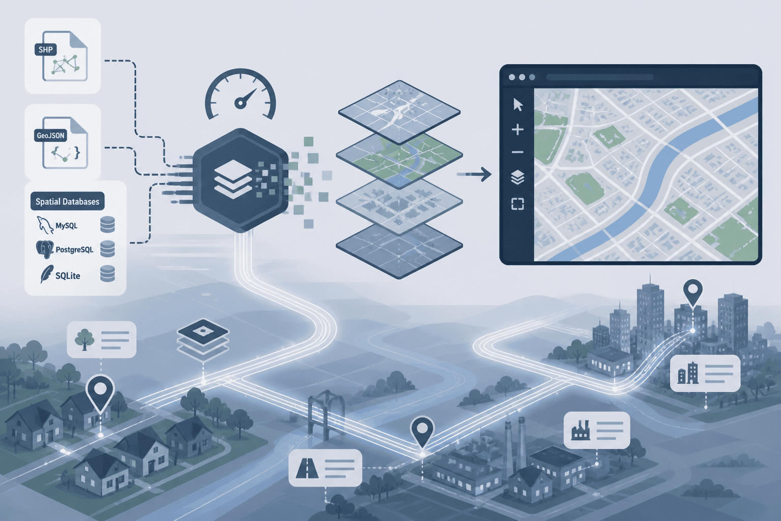
Effortless Data Integration
Turn your Shapefiles, GeoJSON, or raw spatial databases into highly scalable vector tiles rendered instantly in the browser.
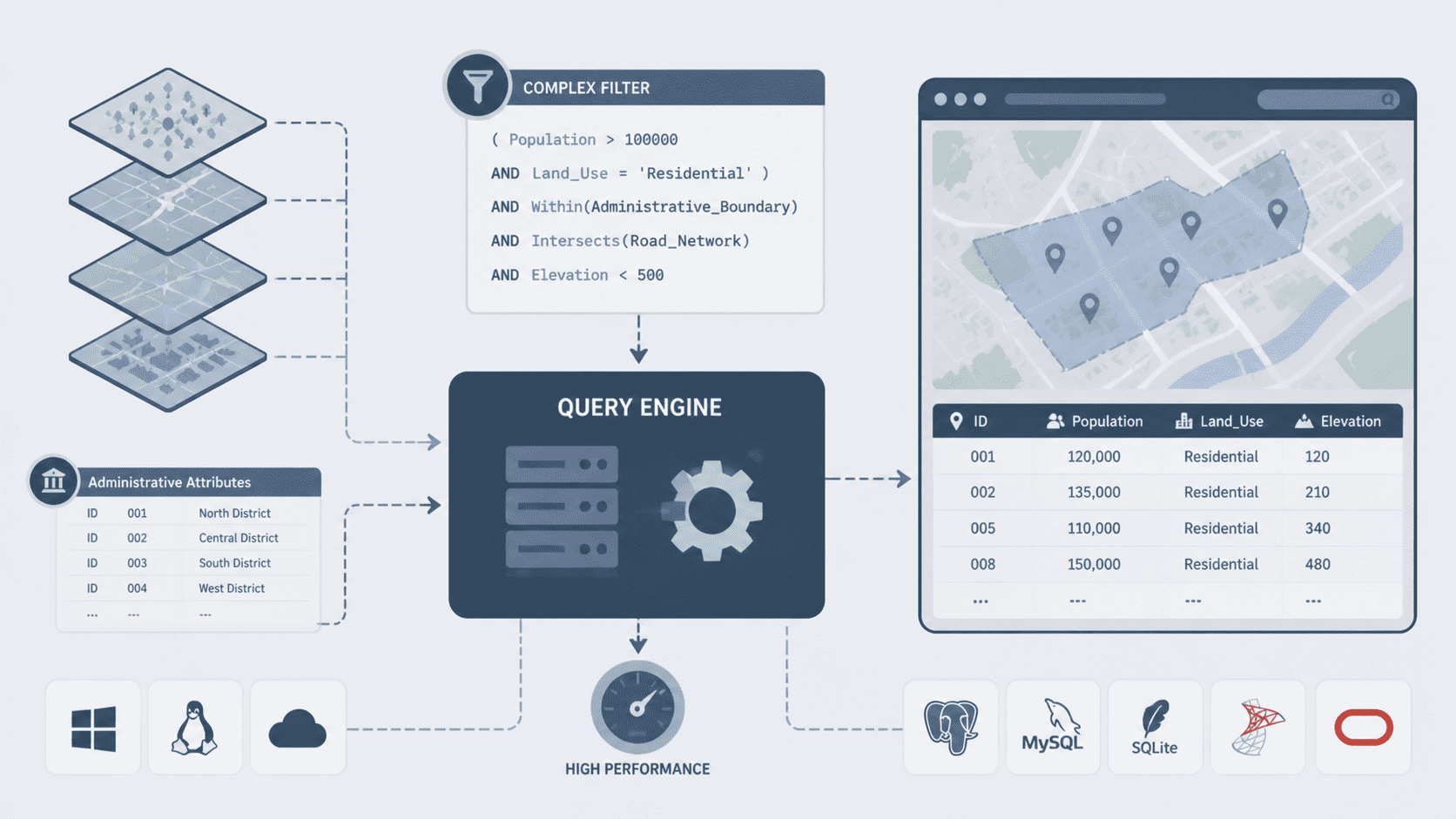
High-Performance Query Engine
Perform complex cross-platform server-side filtering combining spatial layers with administrative attributes effortlessly.
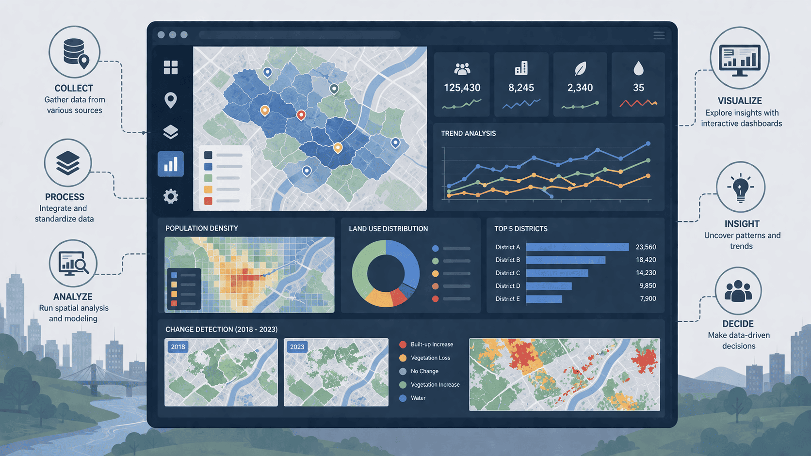
Actionable Spatial Analytics
Transform collected geographic data into highly informative analytics and interactive dashboards. Gain deeper insights to drive better decision-making for your region.
Effortless Installation & Cross-Platform
Setup is incredibly easy with our built-in installation wizard. Our platform is completely cross-platform, working seamlessly across PostgreSQL, MySQL, SQL Server and SQLite databases.
Built for any governance use case
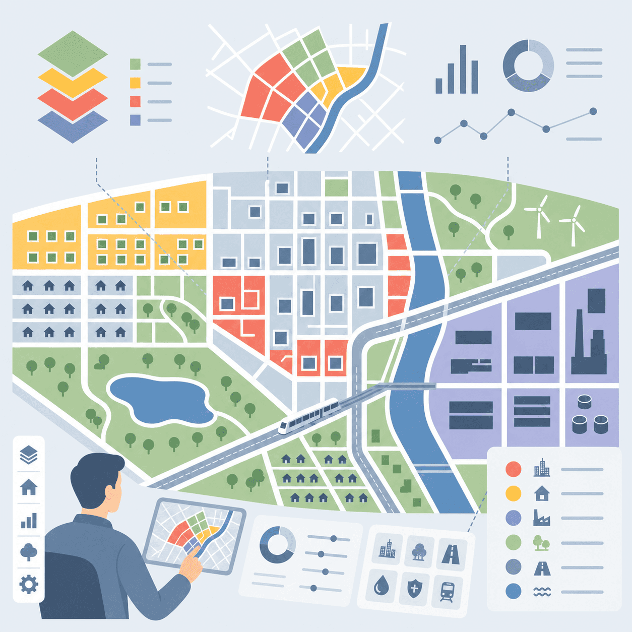
Smart City Planning
Analyze zoning laws, manage urban development, and visualize city infrastructure in real-time.
Asset Management
Map public facilities, track inventory securely, and manage regional assets dynamically.
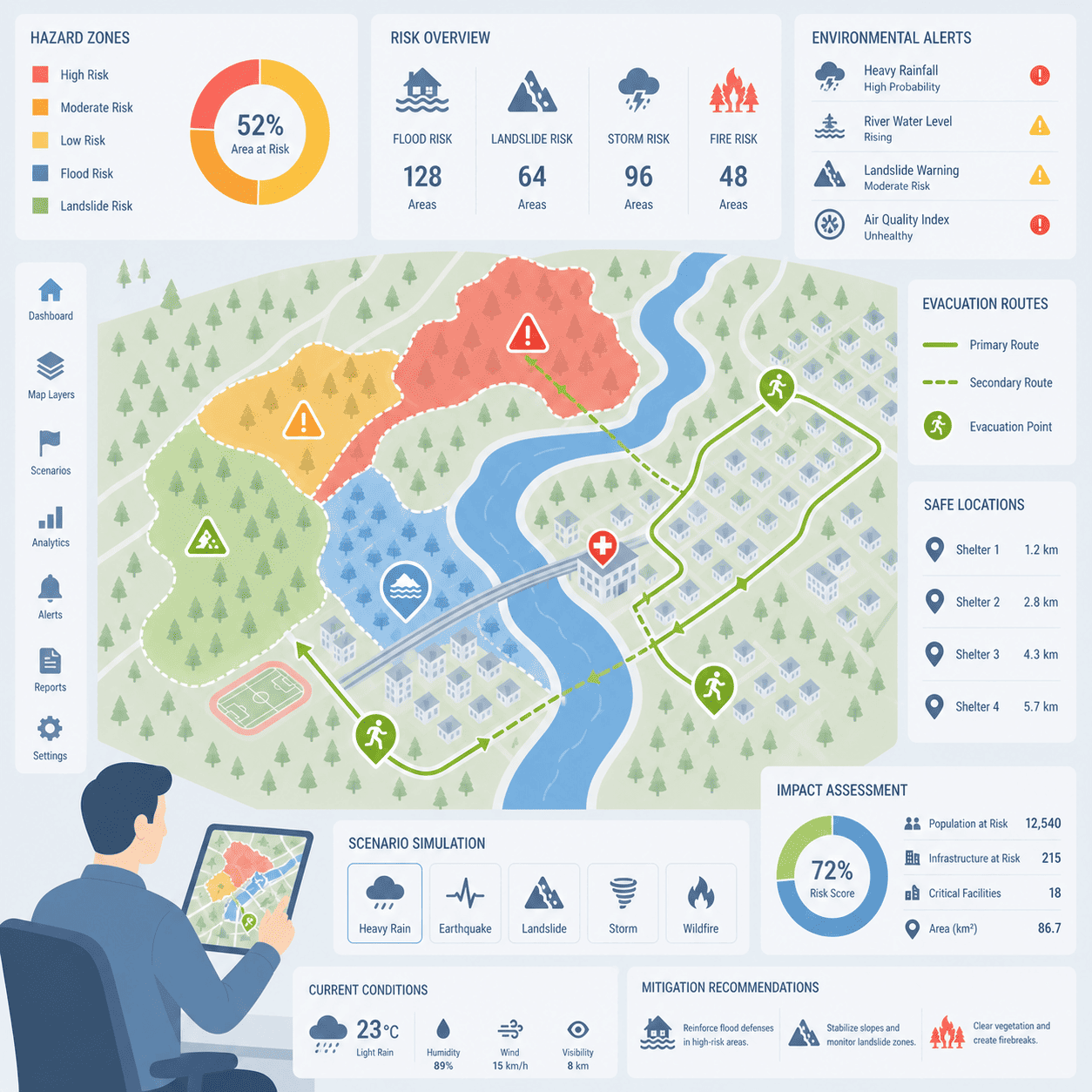
Disaster Mitigation
Visualize hazard zones, plan evacuation routes, and assess environmental risks accurately.
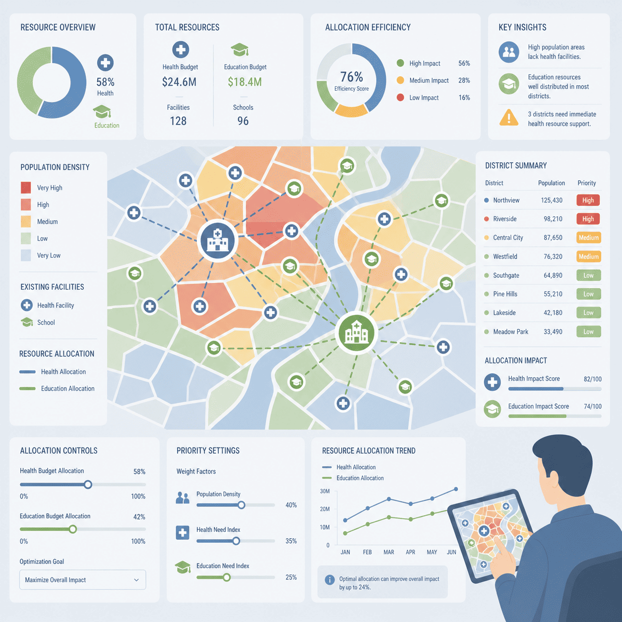
Resource Allocation
Distribute public health and education resources optimally based on demographic heatmaps.
Community & Engagement
107
Daily Visits
Unique visitors today.
934
Weekly Visits
Total visits this week.
737
Monthly Visits
Total visits this month.
5,553
Yearly Visits
Total visits this year.
16
Published Articles
Total content available.
0
Interactions
User comments & feedback.

Latest news

2 months ago
Hello World!
A 'Hello, World!' program generally is a computer program that outputs or displa...
2 months ago
Biggest Football Stadium
Fusce blandit nibh lorem, vitae condimentum turpis porttitor non. Donec in phare...
2 months ago
Facebook Launches Its New Application
Etiam posuere congue massa ut consequat. Vivamus suscipit quis lacus vel tincidu...
2 months ago
Is Coffee Good For Health?
Fusce eget vulputate felis. Cras eleifend tempor purus quis semper. Nulla ac nis...
Build Your WebGIS Today
Get the complete source code of Aksara WebGIS and start building your own geospatial platform without limitations.